Beach photography welcome page > Introduction > Location map > Photography Site A
Manasquan Beach Photography
Photography Site A
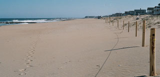
North-facing photos at this site: Set 01
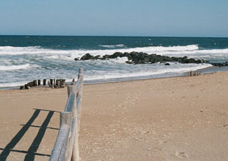
South-facing photos at this site: Set 02 SE toward the water, and Set 03 S down the beach
Additional photos at this site: -none-
| Notes | Illustrating Photographs |
|---|---|
|
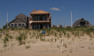
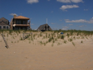
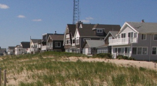
At the north boundary of Manasquan with Sea Girt. Now in 2010 I think I more or less have it. My blue backpack marks the spot in the top three photos (note the flagpoles). The fourth photo is an enlargement of Photo Set 3, and the fifth (bottom) photo is another photo that I took in 2010 from the Set 3 spot which extends the shot of the houses northward a bit. I think there are now enough finding aids to be able to keep standing in the same spot. Now striking the text that was here before the 2010 photos were taken— |
|
|
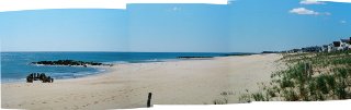
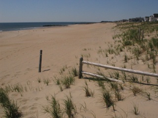
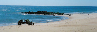
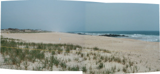
2010 - Well after a decade of erosion, things are starting to look like they did in 1997. From top to bottom— (1) A three-picture composite of the south looking scene (Photos 2 and 3 plus another bridging one). The fence is different again! (2) Here is the end of the fence. (3) In the photo from 2010 you can see how the wooden groin is emerging and the scene is more and more resembling what it (4) looked like in 1997. |
|
|
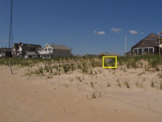
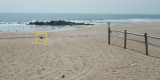
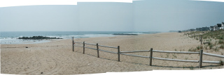
2008 - I cannot seem to find the permanent location for this site. I've been trying to line up the buildings although they keep changing. I think the fence moves too. (You can see that it's different from '03 to '06 to '07. The buried groin keeps emerging/disappearing too. The view north into the camp keeps changing with the changing landscape too. I'm in the right area, but each year is a little different. The yellow square in the photo at top right surrounds my backpack which is sitting on the sand. The end of the wood groin was not visible from where I was standing, but some of it was showing into the beach. Projecting over the backpack leads to the end of the groin. That doesn't mean that I have the geometry correct to be standing over the groin, just that the line-of-site passing over the backpack points at the end of the groin. I think I need to be a little closer to the fence, but at the same angle to the houses. At center right is a three-picture composite of the south looking scene (Photos 2 and 3 plus another bridging one). (Hopefully I'll find the same fence next year.) At bottom right is a two-picture composite of the north view (Photo 1 plus another). |
|
2007 - The photography site this year was right at the fence, right near the toe of the dune (Top, at right). O.K. now things get interesting. Perhaps the old groin at the Sea Girt border is still there (Middle, at right). I once thought it had been removed (see notes below and Set 02) but now the end of it seems to have re-emerged. Plus, additional erosion to the north of the rock groin is making the scene look very much like it did in 1997 (Bottom, at right). If I had been standing a little north and was turned a wee bit I think I could have recreated the 1997 view looking down the wooden groin at the end of the rock groin. |
|
| 2006 - Writing with additional evidence available to me now in 2007, I would say that quite a bit of sand was lost between 2003 and 2006. Using the horizon and the rock groin to establish a general vertical position, the beach seems lower and not as far to seaward. | 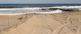 |
| 2003 - Whatever I was thinking in 1997 about documenting this site was forever lost to memory when I came upon the site in 2003. The wooden groin (see Set 02) that provided such an easily identifiable reference was no longer available. It looked like the Army Corps beachfill project did away with it. The stone groin immediately south also appeared to have been altered by the Corps. | 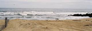 |
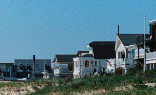
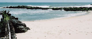
| 1997 - Pre-beachfill photography. This view is a composite of photo Set 02 and Set 03. These two sets only join together with the 1997 photographs, perhaps I did have a plan that Site A would be a composite scene, but if I did in 1997 I forgot about it by 2003. | 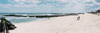 |