Beach photography welcome page > Introduction > Location map > Photography Site L
Manasquan Beach Photography
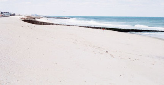
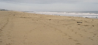
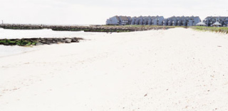
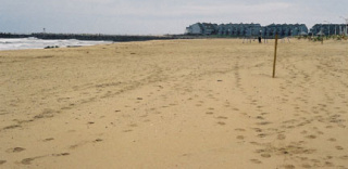
Photography Site L
North-facing photos at this site: Set 22
South-facing photos at this site: Set 23
Additional photos at this site: -none-
| Notes | Illustrating Photographs |
|---|---|
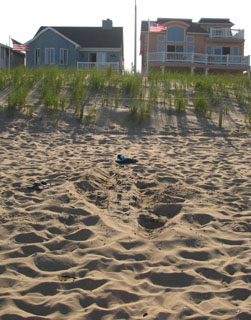
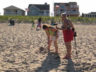
Aligned with the wooden groin at 385 and 381 Beachfront, south of Whiting Avenue. The site is north of the stone groin that is north of the inlet jetty. At right: on June 25, 2007 I found the hidden wooden groin. I knew it had to be around here because it is visible in the 1997 photo from Set 18 (see notes below), but I had never been able to exactly locate it before now. As I was exposing the groin (top photo, the blue backpack is right atop it) I noted some women using metal detectors on the beach. They were getting a nice metal response, but couldn't locate any treasure (bottom). I believe they had also "found" the groin that I had been looking for. Some metal spikes or tie rods were probably several feet down into the beach. |
|
| 2010 - No comments. | -x- |
2008 - This site had essentially been abandoned since the original 1997 photography. Errors in 2003 resulted in the north-facing and south-facing photos from here being taken at other sites instead (see notes below). It is very hard to appreciate how much the beach and buildings had changed from 1997 to 2003. Anyway the 2003 mistakes were accepted and the new photo sites were occupied in 2006 and 2007, so no photos those years at Site L. As part of the project overhaul that followed the 2007 photos, I decided to keep the new sites that resulted from the 2003 errors, but to also reestablish Site L. It is impossible to replicate the 1997 photos exactly because of the increased dune height and all the new houses. So the north facing Set 22 of 2008 is the new reference photo for here. |
-x- |
| 2007 - No photos this year. | -x- |
| 2006 - No photos this year. | -x- |
2003 - No photos this year. The north-facing photo that was taken here in 1997 was taken at Site M (south of here) in 2003 by accident. The south-facing photo that was taken here in 1997 was taken at Site K (north of here) by accident in 2003, and Site K has been reoccupied since then. The beachfill covered all, and buildings were either in both photos (south view) or too far away to identify (north view). |
|
| 1997 - Pre-beachfill photography. In the photo at right (Set 18 from 1997) you can see the groin that is the location for Site L. The photo faces south, and moving from south to north: (1) there is the jetty on the north side of the inlet—Site N, (2) there is a stone jetty that extends into the water—Site M, (3) there is a short wooden groin that ends in the beach which is Site L, (4) there is a wooden groin that extends into the water in the foreground—Site K. | 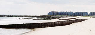 |